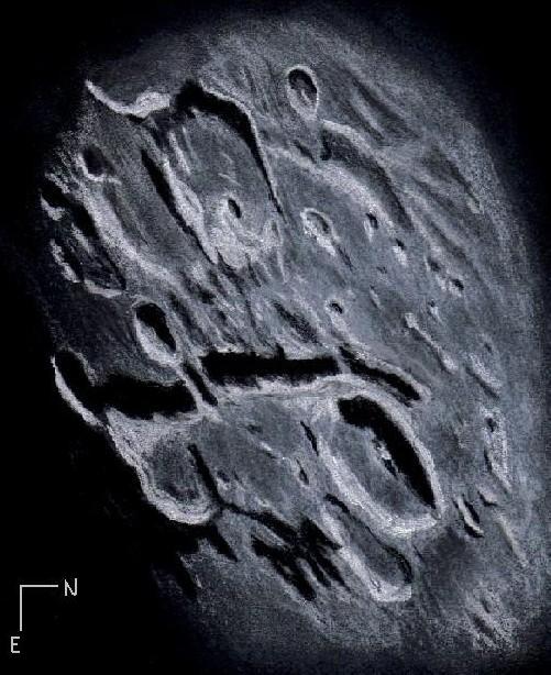
The Region of Vallis Rheita
Very early Sunday morning the moon was approaching the meridian about 35° above
the southeastern horizon when I decided to take a closer telescopic look and
select a sketching target. Prominently on display near the sunset terminator was
the famous 330 kilometer long Vallis Rheita. This valley formed as a by-product of
the secondary blocks thrown from the mare Nectarius basin forming event that
occurred 3.92 billion years ago. Apollo 16 astronauts John Young and Charles Duke
collected rock samples that included ejecta from the Nectarius event which
permitted the dating. A multitude of monstrous blocks heaved out from the initial
impact to the south created this less than regular catena. The valley lines up
nicely with the west central region of the Sea of Nectar accounting for this
hypothesis.
Adjacent to the northern end of Vallis Rheita and slightly younger in age is
crater Rheita, a 70 kilometer gouge with a low central peak and a fairly sharp
crest. Across the deep valley from Rheita to the southwest is 88 kilometer crater
Metius with its 4 kilometer high walls and small crater Rheita B east of a pair of
low ridges on the crater floor. This highland region of the moon is very old and
battered. It was showing some of its best features in the setting sun.
Sketching:
For this sketch I used: black Strathmore 400 Artagain paper, 8”x 10”, white and
black Conte’pastel pencils and a blending stump. Brightness was slightly decreased
(-5) and contrast increased (+5) after scanning using Microsoft Office Picture
Manager.
Telescope: 10 inch f/5.7 Dobsonian and 6mm eyepiece 241x
Date: 2-24-2008 0:10-1:00 UT
Temperature: -8°C (19°F)
clear, calm
Seeing: Antoniadi III
Co longitude: 123.2°
Lunation: 17 days
Illumination: 90.1 %
Phase: 323.3°
Frank McCabe


Beautifully sketched, Frank! Thanks for all the research you put into the description.
Jeremy
Thank you much Jeremy, it was a very nice sight to behold and much fun to sketch and research.
Frank